LiDAR survey maps 2.65 million young trees across 569 km² of Cairngorms Connect in Scotland
Airborne LiDAR at 22 pulses per m² detected young trees regrowing after deer culling in the Scottish Highlands. The authors say the pipeline can be scaled to national mapping.
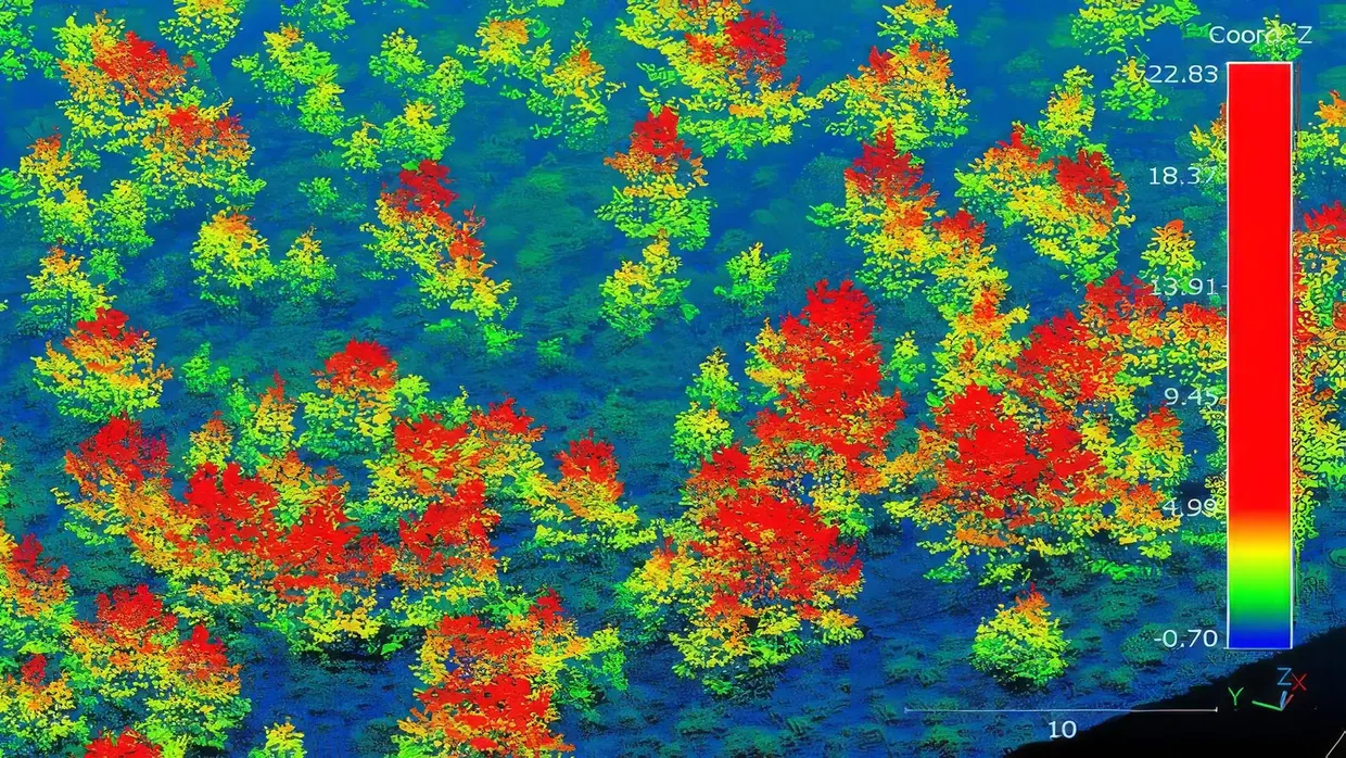
Researchers led by the University of Cambridge, with RSPB Scotland and Cairngorms Connect, mapped natural tree regrowth across a 569 km² site in the Scottish Highlands using airborne LiDAR, according to a paper in the Journal of Applied Ecology wiley.com
Journal of Applied Ecologywiley.comOpen source ↗. Cairngorms Connect is the largest contiguous restoration partnership in the United Kingdom. The pipeline delineated 2.65 million young trees under 5 m in height. The scan was commissioned in July 2023.
Sustained deer culling in parts of the Highlands is resulting in natural recolonisation of open landscapes by woodland. The authors estimate that 5325 ha of previously non-forested land now has a sapling density above 100 per hectare. According to the authors, the colonisation was largely natural, with small areas of planting where no seed trees were nearby.
How the LiDAR pipeline works
The survey used a pulse density of 22 per m². Young trees are hard to see because a young pine can be shorter than the surrounding shrubs, which reach up to 1.1 m. Clusters of regenerating trees become detectable once they outgrow these shrubs. Detection reached 83% for clusters 1.4–1.6 m tall and above 95% for those taller than 1.8 m. Trees below about 1 m were almost all missed.
Validation used young trees that were geolocated and measured in the field. Height estimates gave R² = 0.94 and canopy cover R² = 0.90, with commission errors of 0.019% wiley.com
Journal of Applied Ecologywiley.comOpen source ↗. Rocks and clumps of bracken, which can be mistaken for trees, were filtered out using colour images from the same flight. The method has been tested only at this one site, with one scanner and one flight height.
What drives regeneration
The team used the map of regenerating trees to build a Hurdle Model. Proximity to seed sources, elevation, habitat type and deer density all strongly affected tree establishment and sapling density. Distance from existing forest mattered most: the farther a patch of ground was from a seed source, the fewer saplings it held. Bogs held fewer young trees than dry heathland.
The authors recommend that forest restoration projects use LiDAR-based pipelines to map young trees, assess whether targets are met and plan further action. The Scottish Government is now commissioning a national airborne LiDAR scan, which would allow the algorithms to be scaled up to create national woodland expansion databases.