NASA tests SPLICE landing navigation payload on Alta-X drone in simulated lunar descent
The SPLICE payload mapped terrain and assessed landing areas during a drone flight at Rogers Dry Lake, California. NASA reports the test raised the technology's readiness level.
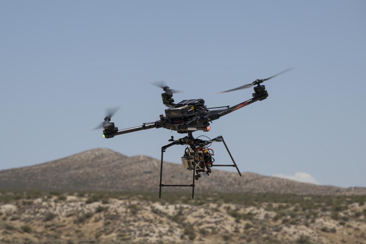
NASA's Armstrong Flight Research Center reported that an Alta-X drone carrying the SPLICE guidance, navigation, and control payload completed simulated lunar descent and landing maneuvers on Aug. 27. The flight took place at Rogers Dry Lake near Edwards, California. SPLICE stands for Safe and Precise Landing – Integrated Capabilities Evolution. nasa.gov
NASAnasa.govOpen source ↗
How the SPLICE payload works
During the flight, the payload mapped the terrain and assessed potential landing areas. If the system determines that the targeted area is unsafe, it diverts the drone to a safer location. It generates high-resolution digital elevation maps from light-detection and sensor data. nasa.gov
NASAnasa.govOpen source ↗
The payload was developed by researchers at NASA's Johnson Space Center in Houston. Specialists at NASA Armstrong integrated it with the drone, tested it, and flew it in June and July. Those tests verified communications, data handling, telemetry, and command-and-control performance between the payload and the drone. They were meant to prepare for a full-scale test at Voyager Technologies in Mojave, California, later this month. nasa.gov
NASAnasa.govOpen source ↗
Readiness level and commercial use
Project manager Davis Adams said the flight is the culmination of almost a decade of work on SPLICE and raised the technology readiness level. According to him, the guidance and navigation systems are applicable to terrestrial, lunar, and Martian descent and landing missions. nasa.gov
NASAnasa.govOpen source ↗
NASA has worked with several commercial lunar lander providers to implement iterations of SPLICE in their platforms. Some of the landers planned for upcoming Moon missions use data NASA collected while developing systems like SPLICE to perform soft touchdowns. Adams said the guidance system is planned to appear in the NASA software catalog this fall. Some companies are also evaluating its navigation capabilities for precision landing and possible extensions to autonomous surface mobility. nasa.gov
NASAnasa.govOpen source ↗
Earlier flight testing was supported by NASA's Flight Opportunities project, based at NASA Armstrong. In 2019, tests covered a descent altitude and a landing trajectory similar to those expected on a lunar mission. In 2020, two NASA-developed precision landing sensor systems were demonstrated. nasa.gov
NASAnasa.govOpen source ↗